


col du loup - truq des aiguilles

Mariolebeno
User
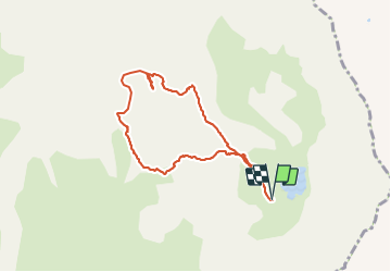

Length
7.4 km

Max alt
2931 m

Uphill gradient
648 m
Km-Effort
16.1 km

Min alt
2460 m

Downhill gradient
658 m
Boucle
Yes
Creation date :
2023-07-10 06:35:30.102
Updated on :
2023-07-18 07:27:41.38
3h39
Difficulty : Difficult

FREE GPS app for hiking
 SityTrail
IGN / Geographical institutes
SityTrail Plus
The world is yours!
About
Trail Walking of 7.4 km to be discovered at Provence-Alpes-Côte d'Azur, Hautes-Alpes, La Grave. This trail is proposed by Mariolebeno.
Positioning
Country:
France
Region :
Provence-Alpes-Côte d'Azur
Department/Province :
Hautes-Alpes
Municipality :
La Grave
Location:
Unknown
Start:(Dec)
Start:(UTM)
291938 ; 4995376 (32T) N.
Comments